Showing posts with label APT. Show all posts

Friday, 14 February 2014

A Conveyor of Low Pressure Areas

So far this year, we have seen a succession of low pressure areas come across the Atlantic straight for the UK, dumping large amounts of rainfall and inflicting very high winds across the country.

Rainfall has been heaviest in the south of the country with heavy flooding in Somerset and across the Thames Valley.

The cause appears to be the jet stream stuck further south and flowing faster than usual, generating a conveyor belt of fast moving, intense low pressure areas.

I had a look through the NOAA APT satellite pictures I have received for the last few weeks and picked out a series of pictures that give an indication of this weather pattern

They all show intense low pressure areas tracking over the UK.

 NOAA 19 - 1st February 2014

NOAA 19 - 7th February 2014

NOAA 19 - 8th February 2014

NOAA 19 - 12th February 2014

The last picture from the 12th February brought very strong winds to the west and north of the country with gusts in excess of 100MPH.

We have yet another low pressure area tracking across the country through today and overnight bringing rain and gale force winds. There was too much noise on the NOAA 19 midday picture from today. The cross dipoles I use to received APT transmissions are located in the loft of the house. We have a large number of tall trees to the south and what with the rain and thick cloud, I suspect this combines to impact the signal received from the satellite.

Friday, 3 January 2014

Weather Report: Continuing Stormy Weather

The stormy weather continues. Heavy rain, hail and winds again today with a low pressure area to the north of Scotland resulting in fast moving heavy belts of rain moving across my location in the south of England.

NOAA APT pictures continue to provide good views of the weather moving across the UK. The early morning and mid to late afternoon satellite passes are still to dark due to the low elevation of the sun at this time of year, however the passes around midday work well.


The above picture is from the NOAA 19, 13:07 pass and clearly shows the low pressure area to the north of Scotland and the stream of showers being fed from the Atlantic over the southern half of the UK.

Just before this pass, there was an intense storm at my location with heavy hail, rain and wind. The following graph is the temperature reading from my "computer shed" and shows the sudden drop in temperature at the onsite of the storm.


The drop is shown just after 12:00. the storm passed through in an hour.

Lots of flooding in the south west of England and along the south coast.

Aerials still holding up with no damage. Still more to come over the weekend !

Thursday, 2 January 2014

Weather Update: A Rare Break In The Rain

A rare day of clear sky and no rain although this is forecast to change later this evening with heavy rain and strong winds returning.

The following is the NOAA19 APT picture received early this afternoon and shows the cloud that produced yesterday's rain over central Europe and Scandinavia with the next low pressure area and cloud bringing this evening's and tomorrow's rainfall to the west, approaching from the Atlantic.


This has been the pattern for most of the last few weeks with a continuous series of low pressure areas spreading across the UK from the Atlantic bringing heavy wind and rain.

The ground is water logged and rivers running very high with localised flooding. The following photo is the Blackwater River not far from my home location.


The river is more than twice the size of normal and is very fast flowing. When I took this photo, the water had receded as the ground around the river had flooded and was still covered in many places.

So far, no aerial damage. The new M0CVO HW-40HP aerial I put up just before Christmas is working well and providing there are no more branches falling from the trees supporting the aerial it should be fine.

Saturday, 7 September 2013

The Last Day Of Summer?

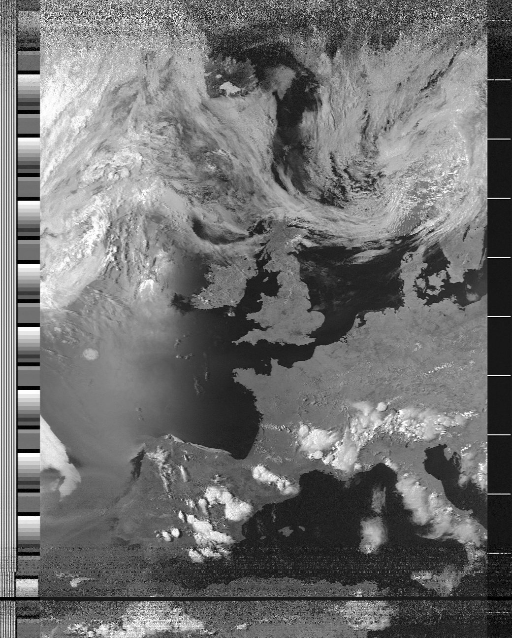
The following picture was received from NOAA 19 on Thursday 5th September. A really good pass from North Africa to Iceland using my cross dipoles in the loft of the house.


The weather at ground level was really good with clear blue sky and in London where I was for the day, the temperature reached 29 degrees centigrade.

The following day, there was a 10 degree temperature drop, cloud and some rain which has continued today, Saturday 7th September.

I suspect that this was the last day of summer and we are now moving into Autumn with Low Pressure from the Atlantic bringing wind and rain.

Thursday, 11 July 2013

Weather Satellite Pictures Keeping Getting Better

Another day of good weather and another day of very good APT weather satellite pictures.

The following is from the 13:05 UTC pass of NOAA 19, again with most of the UK cloud free.


It is a cropped image, however the overall duration of  the pass was again excellent and shows what can be done with a simple loft antenna.

The cloud cover coming off the North Sea onto to east coast is quite a common occurrence. It is interesting to compare what the weather is like at ground level against the satellite picture. There are many really good webcams that enable this to be done very easily. A good set of webcams on the coast of Norfolk are on the Happisburgh Lighthouse. See the following link: http://www.happisburgh.org/webcam

The whole Happisburgh site is worth a read and the village is well worth a visit. Check for the days when the Lighthouse and the Church Tower are open. Views from the top are excellent.


Tuesday, 9 July 2013

Good Weather At Last !

The weather for the last week has been excellent with high pressure covering much of the country resulting in very warm conditions, reaching 28C and clear skies.

As well as Eumetcast, I still receive APT transmissions from the NOAA satellites and during summer with the sun at a high angle the received pictures are excellent.

The following is the picture as received (with minor contrast enhancement) from NOAA 15 late this afternoon:


Most of the United Kingdom is cloud free and London and Birmingham stand out well as slightly darker than their surroundings.

I receive the polar orbiting NOAA satellites using a Timestep receiver which is almost 20 years old and has been in use almost 24 by 7 for all that time. The antenna is a turnstile cross dipole style of antenna located in the loft of the house which makes the duration of pass and received quality all the more surprising.

The Timestep receiver feeds audio to the computer soundcard and the audio is processed into pictures by the excellent WXtoImg.